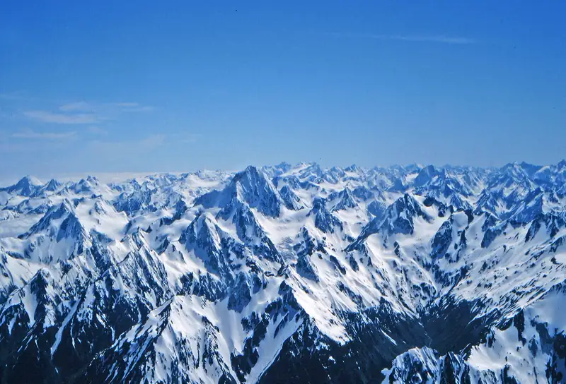
The Christchurch to Queenstown drive is about 486 km on the inland route through Lake Tekapo, Twizel and Lindis Pass, and RealNZ puts the driving time at about 7 hours 15 minutes. Split it over two days to add the side trip to Aoraki/Mount Cook. InterCity's daily bus does it in about 8 hours 10 minutes.
The drive from Christchurch to Queenstown is about 486 km and takes about 7 hours 15 minutes on the inland route, according to RealNZ’s South Island driving table. The road crosses the Canterbury Plains, climbs into the Mackenzie Basin at Lake Tekapo, runs past Lake Pukaki with Aoraki/Mount Cook at its head, then crosses Lindis Pass into Central Otago. Do it in one long day, or split it to see more.
Travel sites often quote about 6 hours non-stop. Treat that as the bare minimum. Mountain roads run slower than map estimates, and you’ll want to stop at the lakes.
Distance and drive times
| Leg |
Distance |
Time |
| Christchurch to Lake Tekapo |
About 220 km from the airport |
About 3 h |
| Fairlie to Lake Tekapo |
|
30 min |
| Lake Tekapo to Twizel |
|
45 min |
| Ōmarama to Lindis Pass summit |
32.5 km |
About 25 min |
| Lindis Pass summit to Tarras |
45 km |
About 35 min |
| Christchurch to Queenstown, whole drive |
486 km |
About 7 h 15 min |
| Side trip: Twizel to Aoraki/Mount Cook Village |
|
45 min |
| Side trip: Lake Tekapo to Aoraki/Mount Cook Village |
About 104 km |
1 h 15 min |
| Aoraki/Mount Cook Village to Queenstown |
|
3 h 10 min |
Checked November 2026. Sources: RealNZ (whole drive), Mackenzie NZ (Mackenzie legs and Mount Cook times), OpenStreetMap routing for the Lindis distances and the Tekapo distance. Routing estimates run short on mountain roads, so add 15 to 25 percent.
The route, stop by stop
Christchurch to Lake Tekapo. The first three hours cross the Canterbury Plains, then turn inland through Geraldine and Fairlie and cross Burkes Pass into the Mackenzie Basin. NZTA advises carrying chains on Burkes Pass in winter.
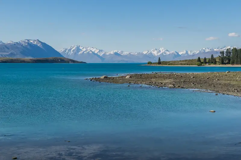
Lake Tekapo. This is the natural first stop. The lake is 30 km long and up to 120 m deep, according to DOC, and the stone Church of the Good Shepherd sits on the shore. Park on the village side of the footbridge and walk across; the church grounds open 9 am to 8 pm in daylight saving and 9 am to 5 pm otherwise, and ask a suggested NZ$5 koha (donation). Read more in our Lake Tekapo and Church of the Good Shepherd guides. If you stay the night, Tekapo is inside the Aoraki Mackenzie International Dark Sky Reserve; see Lake Tekapo stargazing.
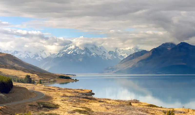
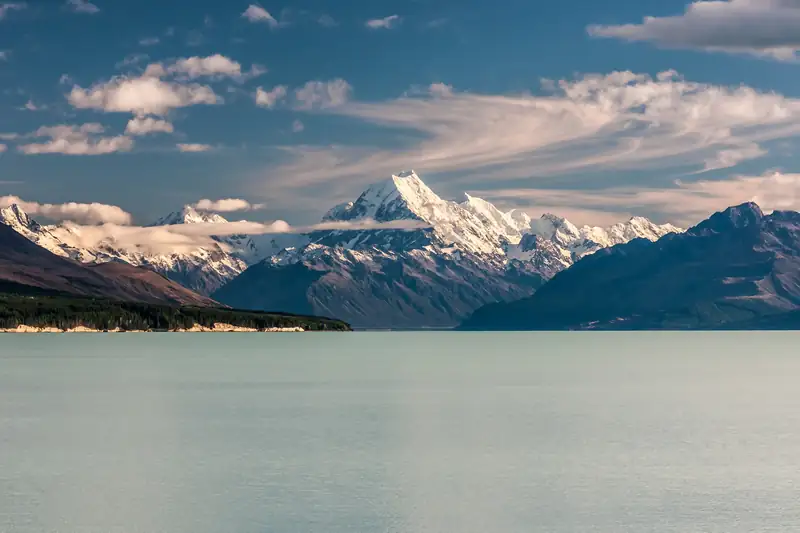
Lake Pukaki. Between Tekapo and Twizel, the road meets Lake Pukaki. On a clear day you look straight up the lake to Aoraki/Mount Cook, the highest mountain in New Zealand at 3,724 m. The turn-off up State Highway 80 to Mount Cook Village is here, and Peters Lookout on that road has the classic view. See Lake Pukaki.
Twizel and Ōmarama. Twizel has a Four Square and a Mobil station, the last easy shopping and fuel before the climb. Ōmarama is the last town before Lindis Pass, about 32 km below the summit.
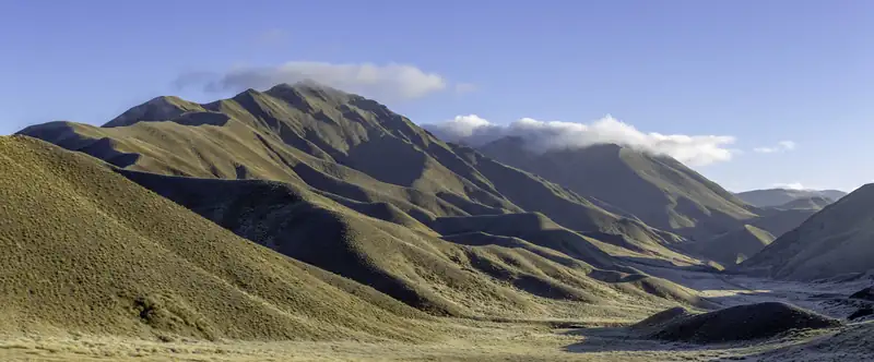
Lindis Pass. The road climbs through tussock hills to a summit of 971 m, according to NZHistory (NZTA’s figure is 965 m). The pass sits east of the main range rather than crossing it, linking the Mackenzie Country with Central Otago. NZTA advises carrying chains here in winter. Our Lindis Pass guide covers the lookout and walks.
Cromwell to Queenstown. From Tarras the road runs to Cromwell, then follows State Highway 6 past Gibbston into Queenstown.
Side trip to Aoraki/Mount Cook
If you add one thing to this drive, make it Aoraki/Mount Cook. Turn off at Lake Pukaki onto State Highway 80, which ends at Aoraki/Mount Cook Village. Mackenzie NZ puts the village 45 minutes from Twizel and 1 hour 15 minutes from Lake Tekapo, and 3 hours 10 minutes from Queenstown.
The detour is not a quick look. The Hooker Valley Track, which DOC says draws hundreds of thousands of visitors a year, is about 10 km return and takes around 3 hours, and parking at White Horse Hill costs NZ$2.50 per half hour or NZ$25 a day by card (checked November 2026). The village has no supermarket and only a card-only fuel pump, so fill up in Twizel or Tekapo.
Our advice: split the drive over two days. Sleep in Tekapo, Twizel or Mount Cook Village, walk the Hooker Valley in the morning, and drive on to Queenstown after lunch. Our Aoraki/Mount Cook guide and where to stay near Mount Cook help with the planning. If you’re only going as far as the mountain, see Christchurch to Mount Cook.
Where to break the journey
Three places work for a night on the way. Lake Tekapo suits stargazers and anyone who’d rather drive three hours on day one; it is 1 hour 15 minutes from Mount Cook Village. Twizel is 45 minutes from the village and has a supermarket and fuel, so it suits families and campervans. Aoraki/Mount Cook Village puts you at the trailheads for a dawn walk, but rooms are few and there’s no shop. Compare them in Mount Cook accommodation and Lake Tekapo accommodation.
Bus, or the long way round
InterCity runs a daily bus from Christchurch’s Bus Exchange on Lichfield Street to the Athol Street car park in Queenstown. It takes about 8 hours 10 minutes, with stops including Ashburton, Geraldine, Tekapo, Omarama, Cromwell and Frankton.
The other road route goes west over Arthur’s Pass, down the West Coast past the Franz Josef and Fox glaciers, then over the Haast Pass to Wānaka and Queenstown. That’s about 372 km from Christchurch Airport to Franz Josef and another 345 km or so on to Queenstown Airport, roughly ten hours of driving before stops. Give it at least two days, better three. You can also take the TranzAlpine train for the first leg to the coast.
Tips for the drive
- Fuel up in Tekapo (Challenge, north end of town) or Twizel (Mobil) before the long, quiet stretch over Lindis Pass.
- In winter, check the NZTA Journey Planner for snow on Burkes Pass and Lindis Pass, and carry chains.
- Drive on the left, and on one-lane bridges a red circle sign means you give way.
- Allow at least an hour at Tekapo and Pukaki combined, more if the mountains are clear.
Ready to plan the whole trip? Our South Island itinerary builds this drive into 7, 10 and 14-day routes.