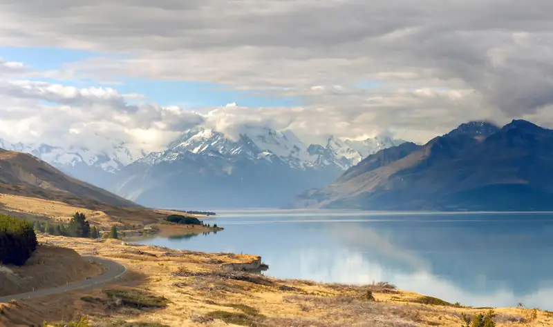
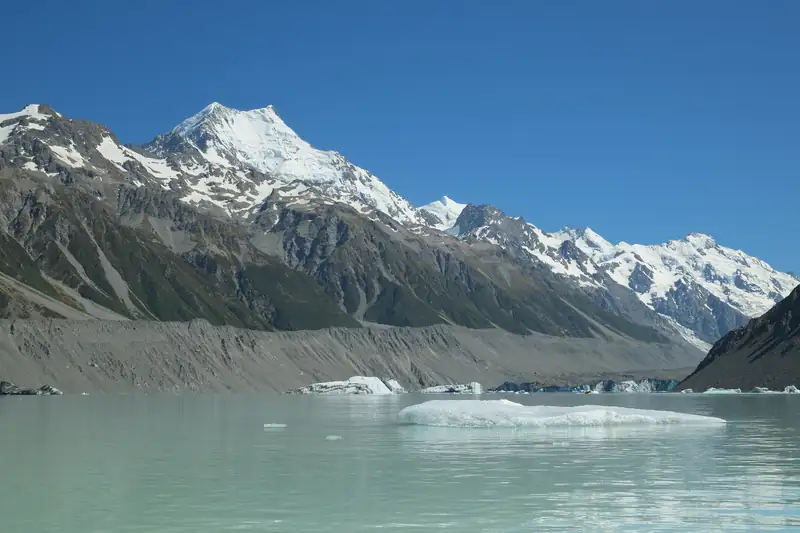
Aoraki / Mount Cook is New Zealand's highest mountain at 3,724 m, measured by a University of Otago team in 2013. It rises in Aoraki/Mount Cook National Park in the central South Island, at the end of State Highway 80. Climbing it takes alpine skills, but the Hooker Valley Track reaches a lake below it.
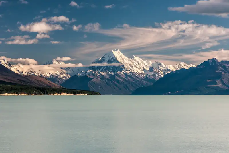
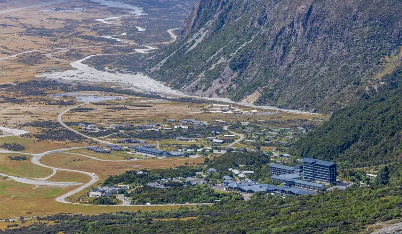
Aoraki / Mount Cook is the highest mountain in New Zealand, at 3,724 m. It stands on the Main Divide of the Southern Alps in the middle of the South Island, inside Aoraki/Mount Cook National Park. The only road in is State Highway 80, which runs along Lake Pukaki and stops at Aoraki/Mount Cook Village, a small cluster of hotels, lodges and a DOC visitor centre.
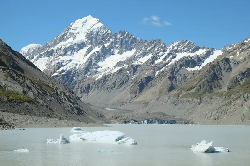
Most visitors never touch the mountain. They look at it. The classic way is the Hooker Valley Track, a gravel path of about 5 km each way that ends at Hooker Lake with Aoraki straight ahead. DOC says to allow 3 to 4 hours return.
Where is Mount Cook?
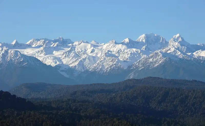
The mountain stands on the Main Divide, the line that separates rivers flowing east to Canterbury from those flowing to the West Coast. On the eastern side are the Hooker and Tasman valleys and the Mackenzie Basin lakes. On the western side are the Fox and Franz Josef glaciers, but no road crosses the range between the two. Driving from the village to Fox Glacier means going round through Haast Pass.
From Christchurch the drive takes about 4.5 hours according to DOC, and from Queenstown about 3.5 hours. Both routes have their own pages: Christchurch to Mount Cook and Queenstown to Mount Cook. DOC warns that snow can limit access between June and September. If you would rather not drive, a small-group day tour from Queenstown stops at Lake Pukaki and then gives you about three hours to walk the Hooker Valley Track; it and other options are on our tours page.
How high is Aoraki / Mount Cook?
The figure has changed twice in living memory.
| Height |
When |
What happened |
| 3,764 m |
19th-century survey, official until 1991 |
The accepted height for about a hundred years |
| 3,754 m |
After 14 December 1991 |
A rock avalanche fell from the East Face; a photogrammetry survey put the summit about 10 m lower |
| 3,724 m |
Measured 23 November 2013, announced January 2014 |
A University of Otago-led team climbed with GPS. The ice cap on the summit had thinned since the collapse |
So the mountain is 40 m lower than the old textbook figure, and 30 m lower than the 1991 estimate. Some older pages, including NZHistory’s first-ascent page, still show 3,764 m. DOC uses 3,724 m.
The Aoraki story (Ngāi Tahu tradition)
The name Aoraki belongs to an ancestor. In the account published by Ngāi Tahu, the South Island’s main iwi (tribe), Aoraki and his brothers brought their waka down from the heavens to visit Papatūānuku, the earth mother. On the way back Aoraki recited a karakia wrongly. The waka fell into the sea and capsized, and the brothers climbed onto the upturned hull. There they turned to stone and became the high peaks of the Southern Alps, with Aoraki the tallest. This is why Ngāi Tahu call the South Island Te Waka o Aoraki.
A 2022 DOC blog names the brothers as the sons of Rakinui, the Sky Father: Rarakiroa became Horo-kōau (Mount Tasman), Rakirua became Mount Teichelmann, and Rakiroa became Mount Dampier. DOC’s park page tells a slightly different version, in which the waka is stranded on a reef and the south wind freezes the brothers. Tellings vary, and Ngāi Tahu’s own material is the place to read them in full.
To Ngāi Tahu, DOC writes, Aoraki “represents the most sacred of ancestors”. DOC asks visitors to take their rubbish out of the park, and climbers to carry out human waste where there is no toilet, because leaving waste is unacceptable to Ngāi Tahu: the waters that flow from Aoraki are sacred.
You will often see Aoraki translated as “Cloud Piercer”. That is a popular reading of the word parts ao (cloud) and raki (sky), not the meaning Ngāi Tahu give. A letter to the Hokitika Guardian was already disputing it in 1921.
Two names: Aoraki and Mount Cook
James Cook did not name the mountain. Captain John Lort Stokes of HMS Acheron named it Mount Cook in 1851, while sailing down the West Coast, in honour of the navigator.
The Ngāi Tahu Claims Settlement Act 1998 renamed it Aoraki / Mount Cook. Under the settlement the Crown vested the title in Te Rūnanga o Ngāi Tahu, which gifted the mountain back to the nation, so it stays inside the national park. The settlement also gave the range its official dual name, Southern Alps / Kā Tiritiri o te Moana.
Climbing history
- 1882: the Rev. W. S. Green and two Swiss guides got within about 20 m of the summit.
- 25 December 1894: Tom Fyfe, Jack Clarke and George Graham made the first ascent, by the Hooker Valley and North Ridge.
- 3 December 1910: Australian Freda du Faur became the first woman on top, with guides Peter and Alex Graham.
- 1940s: Edmund Hillary learned his snow and ice skills in these mountains, climbing with guide Harry Ayres, whom he met in 1946. In early 1948 the two of them, with Mick Sullivan and Ruth Adams, made the first ascent of the South Ridge, later named Hillary Ridge (sources give 30 January or 6 February).
Can a beginner climb Mount Cook?
Not as a beginner. Adventure Consultants, one of the companies that guides the peak, only accepts returning clients who meet set requirements: at least 14 days on crampons in the past two years, experience of long alpine days, and enough fitness to climb 1,000 vertical metres with an 8 kg pack in 3.5 hours or less. Clients fly to the Grand Plateau, and the price covers a 6-day period.
If you want height without ropes, the Mueller Hut route climbs about 1,000 m from the village. DOC says that in summer it needs moderate tramping experience, and in winter mountaineering skills.
Walks in the national park
| Walk |
Distance and time |
Climb |
Notes |
| Hooker Valley Track |
About 5 km one way; 3 to 4 h return (DOC) |
Gentle |
Three swing bridges, Hooker Lake at the end |
| Kea Point Track |
About 3 km |
180 m |
Deck over Mueller Lake facing Mount Sefton |
| Sealy Tarns Track |
3 to 4 h return |
600 m, about 2,200 steps |
Steep, no shelter |
| Mueller Hut Route |
About 4 h up, 3 h down |
About 1,000 m |
Alpine route; hut bookings needed 2 Nov 2026 to 2 May 2027 |
| Tasman Glacier View Track |
About 15 min one way |
300+ steps |
View over Tasman Lake; see Tasman Glacier |
Checked November 2026 against DOC track pages.
Glaciers cover about 40 percent of the park. DOC says the Tasman Glacier, New Zealand’s longest, is clearly visible from the highway at the park entrance; its park page gives the length as 23 km. If you would rather see the summit from the air, Mount Cook scenic flights compares the plane and helicopter options.
Is Mount Cook Village worth visiting?
For walkers, yes. The Hooker Valley, Kea Point, Sealy Tarns and Mueller Hut tracks all start in or next to the village, so you can be on the Hooker Valley path at first light, before the crowds, and still have the evening for Kea Point. DOC says White Horse Hill car park can run out of spaces between 10 am and 4 pm from November to March.
Know what you are getting. DOC lists a day shelter with toilets and coin showers, the visitor centre, a petrol station and a few places to eat. There is no supermarket. The Hermitage says the nearest shop is in Twizel, 66 km away, and the fuel pump takes cards only. At night the Hermitage runs a planetarium and telescopes, and the park is inside the Aoraki Mackenzie International Dark Sky Reserve. For rooms, camping and the Twizel and Glentanner options, see Mount Cook accommodation and White Horse Hill Campground. For a longer list of activities, see things to do in Mount Cook.
Fees and rules
| Item |
Cost or rule |
| Park entry |
Free |
| White Horse Hill car park |
NZ$2.50 per half hour, NZ$25 a day; first 20 min free; card only |
| White Horse Hill Campground |
Adult NZ$20, child NZ$10 a night; book online |
| Mueller Hut |
From NZ$50 to NZ$62 an adult a night, by season |
| Visitor centre (1 Larch Grove) |
8:30 am to 5 pm Oct to Apr; 8:30 am to 4:30 pm May to Sep |
| Drones |
Recreational use not allowed anywhere in the park |
| Dogs |
Not allowed |
Checked November 2026 (DOC).
The government plans a charge for international visitors at Aoraki/Mount Cook. A bill was introduced in May 2026 and has not passed, so there is no charge yet and no confirmed amount. Check DOC before you go. Separately, many overseas visitors (not Australians or Pacific Islands citizens) pay the NZ$100 International Visitor Conservation and Tourism Levy with their NZeTA or visa (Checked November 2026).
DOC also asks you not to feed kea, the alpine parrots. Human food can kill them.